
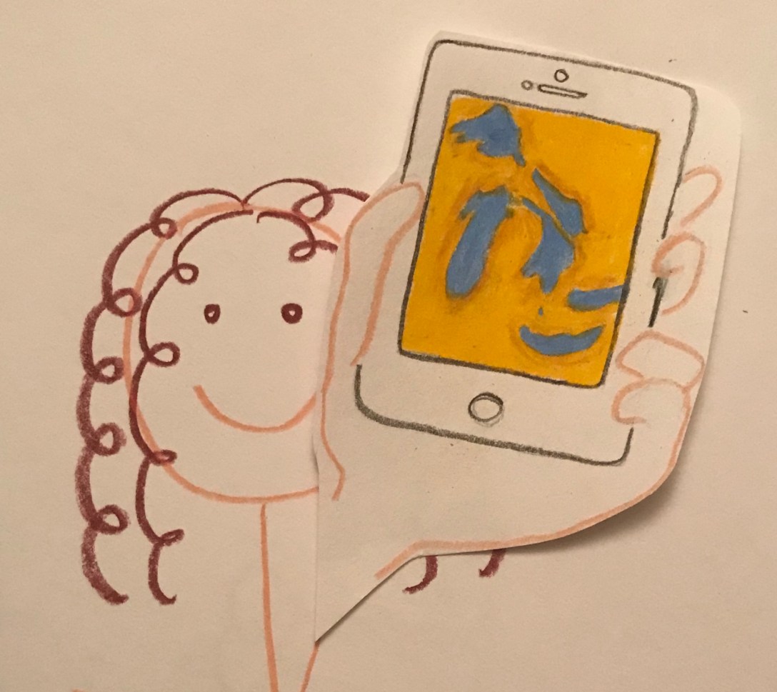
When I was asked by a colleague to check out what phone applications existed for Great Lakes issues, I wasn’t sure what I would find. After some research, I am pleased to report that there are a lot of folks in the region who have come up with some really useful apps around these issues. Even more interesting, is the number of apps that harness the power of crowd sourcing and citizen scientists. I hope as you browse through the apps below, you will find at least one that intrigues you to learn more and perhaps record and share information with scientists and your community. All apps are compatible with the iPhone and free (with the exception of the weather app).
Invasive Species
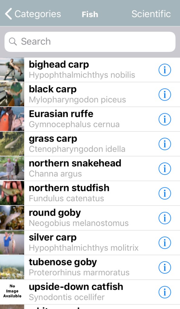
GLEDN’s species list with identifying characteristics (similar to MISIN). 
MISIN’s reporting page.
The threat that invasive species represent to the Great Lakes region is both monetary ($50 million spent annually on Asian Carp control alone) and environmental (invasive species outcompete native species and thereby destroy habitats). Not surprising then, there are a few apps out there focused on reporting invasive species. Both the Midwest Invasive Species Information Network (MISIN) and the Great Lakes Early Detection Network (GLEDN) apps provide lists of invasive plants and animals with basic information, allow users to report using photos and exact location, and share these reports with the appropriate authorities. The goal of these apps is early detection of and rapid response (EDRR) to the presence of invasive species. Since scientists cannot be everywhere at once, it makes perfect sense to inform the public and enlist their help.
Side note: I did wonder, however, if these two apps, serving the same function, were communicating. To help answer this, I looked to app developers and their partners:
| MISIN | GLEDN |
| – Michigan State University – lead – Michigan Department of Natural Resources – Michigan Dept of Agriculture and Rural Development – Michigan Natural Features Inventory – Shedd Aquarium – Great Lakes Restoration Initiative |
– University of Georgia, Center for Invasive Species and Ecosystem Health – lead – Ohio State University Wisconsin Department of Natural Resources – CMB – National Park Service – University of Wisconsin-Extension – Great Lakes Restoration Initiative |
For: Citizen scientists such as the forest preserve visitor who spots Kentucky Bluegrass or the fisherman who catches an alewife, who can then report their findings.
Farming
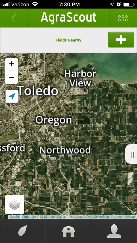

Because farming is an important industry in the Great Lakes basin, I explored apps in this field. Similar to the above, Agrascout allows farmers to report pests or other crop issues, so farmers can know what is happening on neighboring farms and how that might impact their fields.
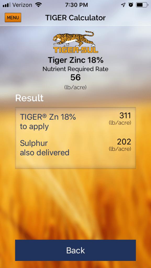
Additionally, there are apps that minimize waste or inefficiency in farming practices. NetIrrigate offers wireless agricultural irrigation monitoring, ideal for water conservation, while Tiger-Sul Crop Nutrient Calculator lets farmers calculate just how much of their nutrient product, such as phosphorus, to put in their soil. Considering the concern of phosphorus leaching into the lakes, this could be another small steptowards managing algae blooms.
For: These apps and others like them are for farmers who use certain products and want to enhance their productivity through this type of technology. These apps differ though, in that they are product-specific. Not every farm is the same and not every farmer embraces technology, but for those who do, in the apps I mention above, I saw the greatest connection to Great Lakes issues.
Water Quality
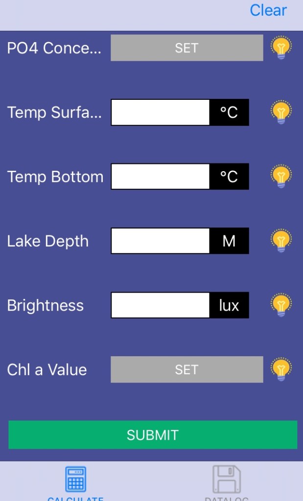
Speaking of algae blooms, in 2015 the EPA promised an app to detect their occurrence. Unfortunately, it would appear this app was never released. One app that does exist is the AlgaeEstimator, created by the University of Wisconsin-Parkside. The idea is to record measurements that can predict if an algal bloom is likely to occur and how long until the algae reaches harmful levels.
For: Scientist and others who have access to tools able to measure surface and bottom temperatures, lake depth, etc.
Side note: As part of the Great River Chicago initiative, work is being done to install instream technology along the Chicago River to monitor water quality data in real time and distribute that data using digital platforms. Similar efforts are underway for the Great Lakes, although I have not yet seen a phone app that allows access to the data.

Swim Guide seems to be a good bet when planning your next beach visit. Swim Guide conducts water quality tests from mid-May to the beginning of September and then rates each beach based on their results. The app directs you to the nearest beaches, based on your location, and uses color coded circles to share these results. Green circle? That beach passed water quality tests at least 95% of the time. Yellow? That beach passed 60-95% of the time. Red? Beach failed at least 40% of the time. Not all beaches are monitored (grey circle) and a red triangle means stay out because the water level is high and surf is dangerous. Additionally, the public can submit their own reports of pollution and beach photos. I’ll be curious to check the ratings after a heavy summer rain when stormwater is likely to overwhelm the system and cause waste and other toxins to flow into the lakes.
For: Beach goers along the Great Lakes, as well as the citizen scientists among them.
Weather
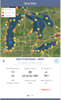
There are also apps for monitoring the weather. Though there are many in this category (most with a one-time fee), the only one in this category with overwhelmingly positive reviews is Great Lakes Boating Weather ($2.99). This app provides NOAA marine weather for the Great Lakes. The reviews rave about the accuracy, the access to wave height, and the various maps.
For: Scientists, fishermen, and anyone else preparing to head out on the water.
Conservation

Developed by students and researchers at the University ofWisconsin-Madison, MyEarth prompts you to think about the ways you can reduce your carbon footprint in your daily tasks. The activities concern: food, water usage, electricity, recycling, and travel. Within these activities you select the tasks that might be done in a day (for example, I wouldn’t select ones about dishwashers because I don’t have one). Then each time you perform a task in a way that saves water, electricity, and so on, you add it to your day’s activities. Maybe one day this app could be paired with a smart plug so we could better understand and manage our electricity use to help improve water quality in the Great Lakes. Because it would be oh so easy to forget to enter your activities each day, the app has a reminder you can set to go off at a designated time each day. The app then displays savings in terms of number of trees saved and water savings in gallons. As you record your conservation efforts, you move to different levels within the app.
For: Folks who are curious to know which daily actions they can adjust to reduce their environmental footprint. Because of the fun polar bear graphics with the advancement of each level, this seems like an engaging way to get kids to think about their conservation efforts as well.
Informational

Then there are apps that are purely informational. Chicago Water Walk provides “fun facts, history, biology, and more” for self-guided walking tours of Navy Pier, the Chicago River, lakefront marinas, and Museum Campus. Because of the locations, I imagined these apps to be geared towards tourists. However, there is probably a thing or two even long-time residents can learn. Topics include invasive species, stormwater issues, and climate change. I appreciated the hyperlinks that directed me to learn more, such as videos demonstrating the impact of the Tunnel and Reservoir Plan on the Metropolitan Water Reclamation District of Greater Chicago’s website. Now I pass by these well-travelled areas with a little deeper understanding of their workings. It would be nice if there were similar apps for other cities along the Great Lakes. Residents and tourists alike can deepen their connection to the waterways that surround them.
For: Visitors and residents who wish to learn more about various points of interest on the waterways of Chicago.
–
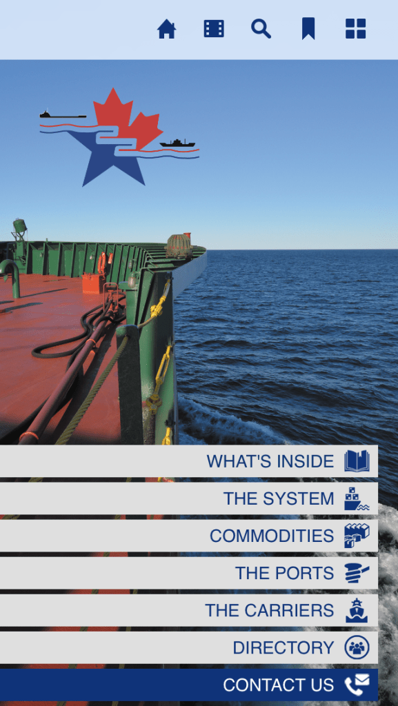
The Great Lakes and St. Lawrence Seaway System Directory app provides the PDF of its directory. With 76 pages, the app breaks the directory down into smaller sections: The System, Commodities, The Ports, and The Carriers. While the directory is informative, the neatest part about this app, for someone who has only ever read about them, is the 4-minute video of locks in action in Quebec, Canada.
For: The Seaway System Directory fulfills its goal to be “an excellent tool for any business or interested individual interested in the Great Lakes Seaway maritime industry.”
——————————————————————-
I was encouraged by what I found thus far; I am sure there are others out there working on all sorts of apps relevant to Great Lakes issues, and I cannot wait to see what they come up with!
Special thanks to Amy Elledge of the Great Lakes Protection Fund, who provided input and feedback for this post!
